![Logo AttriX Bleu.svg]](https://support.attrix.ca/hubfs/Logos/AttriX/Logo%20AttriX%20Bleu.svg)
A trip begins when the vehicle starts moving and ends when the vehicle starts moving again after a stop. A stop is registered when the engine ignition is switched off or when the vehicle speed is below 1 km/h for more than 200 seconds.
Viewing a Trip's History
There are two ways to view a vehicle's trip.
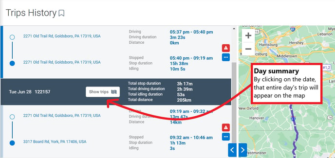
To view a trip's history by dates, the best option is to go to the Trips History tab.
- Select Productivity from the main menu.
- Choose the vehicle(s) from the drop-down list to view its current location on the map

To view a vehicle's last journey (24 hour display)
- Select Map from the main menu.
- Choose the vehicle(s) from the drop-down list
- Press the black arrow (see red circle on the example)
- Press See Trip

Understanding the history of a trip
The history of trips is recorded by the second.
The stops will be indicated in the route on the left of the map.
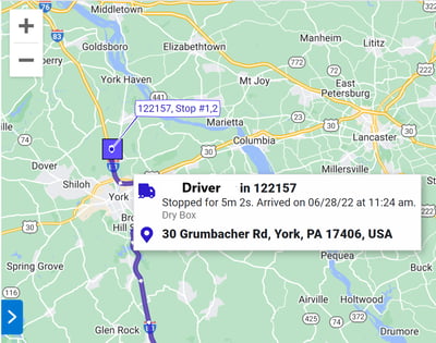
- Select the stops manually by clicking on the addresses indicated.
- Each selected stop will be numbered for quick identification

Day Summary
Explanatory icons
Square: The vehicle is stopped (the address will be indicated)
Star: The vehicle is stopped in a zone (the name of the zone will be indicated)
Arrow: The vehicle is moving. The arrowhead indicates the direction in which the vehicle is moving.
The vehicle track line
The vehicle track line is color coded to the type of exception that occurred. When multiple exceptions occur, the line is striped in alternating colors. In case the exception line is too short to be visible, a warning triangle is used instead.
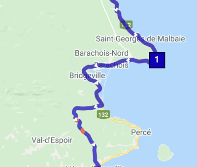
Vehicle direction
The direction along the journey is indicated by arrows. A numbered star indicates a stop inside a known area, and a numbered square indicates a stop outside a known area.
Note: A star is only visible to members of the group in which the area was posted. If the device is not a member of the group, the zone is unknown and the stop remains a square.
Informations
As you move the computer mouse along the route outline, informations about your selection is displayed, including:
- Vehicle name
- Time, date and address
- Movement progress
- Exceptions
- Road speed